
Winslow Township Neighbors by Parcel
The best local route for nearby-property research begins with the Camden County map, not a general name search. The County's myiDV viewer can find an address, owner, street, block and lot, or PIN. After a parcel is selected, its Mailing Labels and Parcel Profile Report tools can produce properties within 200 feet. This is a defined parcel-radius method for Winslow Township neighbors. It can identify parcels and recorded-owner context, but it cannot establish who occupies every home or who should be contacted.
| Source | What it shows about a block | Access |
|---|---|---|
| myiDV Mailing Labels | Properties within 200 feet of a selected parcel | Public County map report |
| myiDV Parcel Profile | Selected parcel and surrounding-parcel context | Public County map report |
| Assessment Hub | Property, owner, and Block-Lot-Qualifier search results | Public County search |
| Camden Clerk records | Document parties and legal parcel chain | Online index from 1978; historical channels earlier |
| Election list | Statutory address-organized election record | County route subject to State law and protection rules |
| Winslow community directory | Organization contacts and local context | Township publication, not an individual directory |
A recorded owner can receive tax correspondence elsewhere. A property location identifies land. Neither fact proves that the owner lives there, identifies every household member, or turns a selected 200-foot report into a full block list.
Winslow Township Neighbors in 200 Feet
Use the County-supported sequence carefully: search by address or block and lot, select the right parcel, choose Mailing Labels or Parcel Profile Report, then compare the resulting parcels with the map. Individual property cards can add parcel-level context. The viewer also has Pan to selected result(s), print controls, and a Measurement Tool for length or area. Those controls help document the geographic decision, such as which side street or oddly shaped lot falls inside the report.
The Camden County myiDV viewer is the local source for the selected-parcel and 200-foot report workflow.
The visible search choices support an address-first approach before any nearby parcel report is generated.
Winslow Township Parcel Owners and Occupants
Parcel information has a narrow but useful meaning. The assessment hub can search Town, Owner Name, Property, BLQ, class, sale date or price, building size, and year built. Set the Town Filter to Winslow Township and use an address or owner detail to identify a parcel. myiDV then helps verify its block, lot, qualifier, PIN, and location. The result is a parcel or assessed-owner lead, not a current household directory. When a public display is incomplete, the Winslow Assessor accepts written property-card requests with block and lot, while the County Board of Taxation has named ownership-verification and related OPRA routes.
A legal description joins the parcel to a recorded instrument. The County Clerk's Property Records Online system can then be searched by party, second party, date, document type, consideration, book/page, file number, or legal Town/Lot/Block. Search name variations and compare the legal description at every step. A deed proves a document relationship to land. It does not establish who is present in the building today.
| Property location | Where the parcel lies, also called the situs address |
|---|---|
| Owner name | The person or entity in assessment data, not all occupants |
| Mailing address | Tax correspondence address, which can differ from the situs |
| Block and lot | The durable parcel locator used for map and legal-record comparison |
Note: A nearby parcel report helps identify land around an address, but it does not explain household relationships or authorize unwanted contact.
Winslow Township Voter Records Nearby
New Jersey law describes registry lists with name, residence address, date of birth, party affiliation, and participation history, organized by street and residence number in the statute's example. Signatures are excluded absent a court order. Participation history does not reveal ballot choices. That structure makes an election record different from a property report, but it does not mean an open web tool can browse everyone near a Winslow address.
The public New Jersey Voter Search is an individual exact-match verification service. State guidance says county-supplied spelling, date of birth, and city or county details matter, including spaces, hyphens, initials, and name changes. The research found no verified public by-street browser. A statutory election-list copy is a County Clerk channel with its own conditions, fees, and protected-address limits, so confirm the current local process with election officials.
Winslow Township Historic Parcel Continuity
Nearby property research gets harder when an old deed has a legal description that does not match a modern street number. Winslow's separate tax-map viewer supplies Block & Lot, Historic Block & Lot, Address, and Map Sheet Number routes. Use Historic Block & Lot as a locator when an older legal description appears to break the modern address trail, then verify the result in County GIS and the Clerk's legal-document search. The research did not inspect every historic-result field, so the map result should be treated as a lead to confirm.
The Winslow Tax Map Viewer offers the Historic Block & Lot route for parcel continuity.
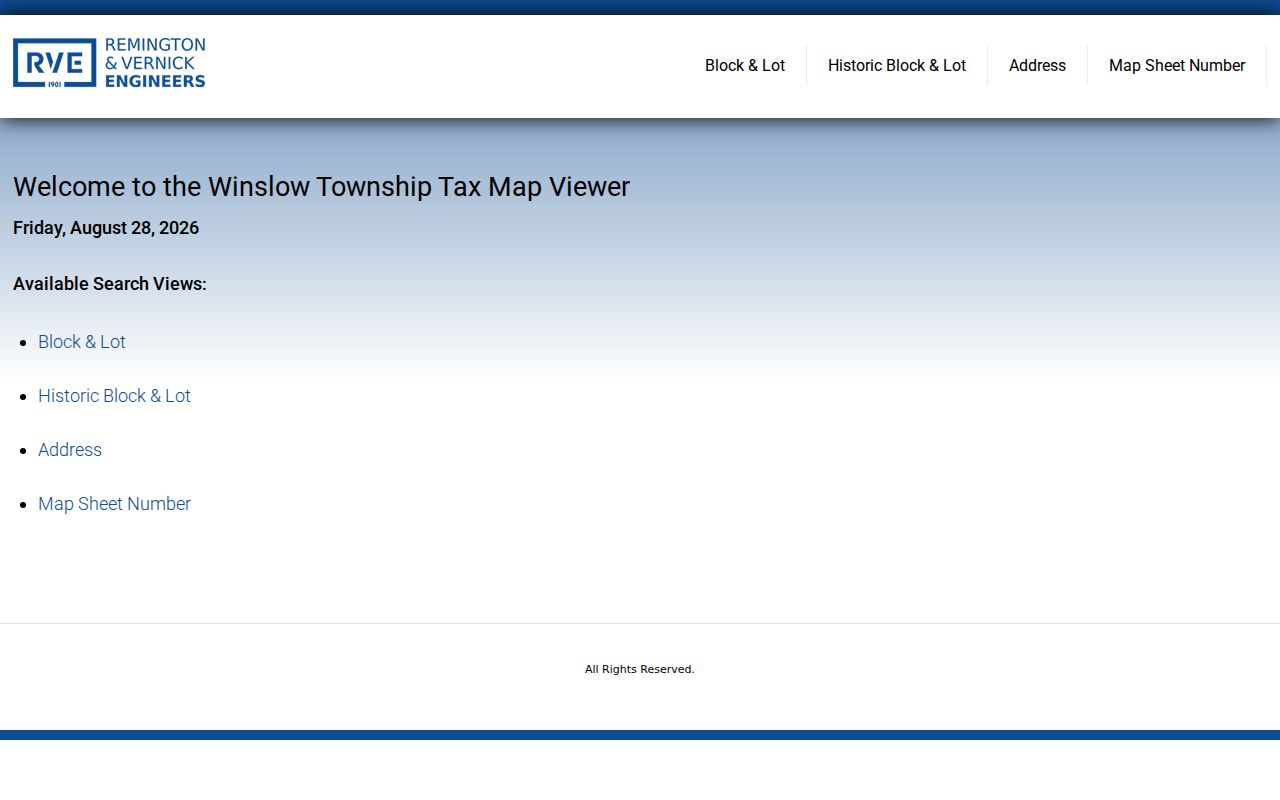
Using the historic route before a deed search can prevent an old parcel description from being mistaken for a vanished address.
Note: A historic map result is a locator to verify against County GIS and Clerk documentation, not a conclusion about present occupants.
Winslow Township Official Parcel Sources
Official parcel and document sources show their limits openly: the map shows land, the assessment record shows assessed-owner data, and the deed index shows recorded parties and legal descriptions. Commercial neighbor tools are a different category. They can combine stale property data and private material, yet they do not replace an official selected-parcel report or a Clerk document. When records disagree, return to the public custodian and the date on the record rather than combining loose name matches.
| Official route | Useful evidence | Limit to keep |
|---|---|---|
| GIS parcel report | Selected parcel and nearby parcel geography | Not a people or contact list |
| Assessment record | Property location, assessed owner, BLQ | Mailing address may not be occupancy |
| Recorded-document index | Party role, date, legal-description connection | Not every document establishes current ownership |
| Commercial neighbor category | A possible lead to test independently | Can be stale, mixed, or incomplete |
Use the source with the narrowest fit for the question. A parcel report is preferable for nearby land, while a dated recorded instrument is the appropriate check for a document relationship.
Winslow Township Community Contacts
Winslow Township's official nonprofit and community directory is useful for finding organizations, not their individual members. It names the Historical Society of Winslow Township, Rotary Club of Winslow Township, American Legion Post 311, senior and community services, and faith or civic groups. No public neighborhood-association umbrella or member roster was located. The Township's block-party notice process also uses a letter and neighbor-signed petition submitted at least 30 days ahead, an administrative event record rather than a continuing neighborhood directory.
Historical Society of Winslow Township
Use for family, hamlet, church, business, and local-history context. Its public materials do not advertise a searchable personal database.
Rotary Club of Winslow Township
A community-contact lead, not a public roster of people living on a particular block.
American Legion Post 311
A civic and veteran-community contact at 2225 Atco Avenue, not a directory of nearby residents.
South County Regional Branch
A local public research point for catalog help, stored telephone directories, and genealogy resources.
Use the Township's organization directory to identify a relevant community contact, while respecting the absence of a member directory.
Note: An organization contact is useful for local context, but it should never be used to infer who lives at a nearby address.
Map a Winslow Township Neighbor Block
The process becomes more reliable when each action answers a geographic question. First identify the subject parcel. Then define the report radius, inspect the shape on the map, and only then compare an individual parcel to assessment or Clerk material. A block can cross a postal label, municipal edge, development boundary, or fire-district area. The map view is the check against an assumption that a short straight-line distance equals the whole block.
- Enter the known address in myiDV Address Search, or use Block/Lot Search when the legal locator is known.
- Select the parcel and verify the property location, block, lot, qualifier, or PIN before generating a report.
- Run Mailing Labels or Parcel Profile Report for the 200-foot surrounding-parcel list and inspect the parcel boundaries on the map.
- Open a property card or assessment record for a specific parcel when owner or locator context is needed.
- Use the Clerk's legal or party search for a dated document question, retaining the legal description as the connection.
For a full named-road record chain rather than the immediate radius, use the Winslow Township streets directory and keep the parcel boundary distinct from a household claim.
Privacy Limits on Local Parcel Research
New Jersey's Address Confidentiality Program, N.J.S.A. 47:4-1 et seq., provides a legal substitute address and mail forwarding for eligible people. Government agencies must accept that address for new records. Daniel's Law, N.J.S.A. 47:1B-1 et seq., separately protects qualifying people and household members from government-web postings of home address and unpublished phone information. A protected or redacted result is not a gap to solve by combining parcel, election, or private data.
Utilities, delivery records, and DMV personal data are not public neighbor lists. A property-card mailing address may be a tax-contact point, and an election record has statutory confidentiality limits. For a correction, contact the appropriate holder: the Winslow Assessor for assessment name or address data, County election officials for voter records, or the County Clerk for a recorded-document issue.
Lawful use. Winslow Township neighbor research is for personal, lawful property and community context. Do not use it to expose a protected address, stalk, harass, threaten, or harm anyone.